2026/04/06
697 view
13 like
A foundational model trained on Earth observation data from Copernicus Sentinel 1 and Sentinel 2 is now widely available to researchers, it was announced this week at a computer industry conference in Denver, USA.
Tessera, an advanced artificial intelligence (AI) model, provides a highly accurate dataset that encodes what satellites “see” the Earth’s surface over the course of a year. This compressed data can be used by the scientific community to generate information-rich maps.
Importantly, encoded datasets (called “embedding”) use much less data than pixelated images sent from satellites to Earth. The model supports a variety of applications, from crop monitoring to measuring fire-burned areas and forest canopies.
A paper on Tessera was presented at the 2026 IEEE/CVF Conference on Computer Vision and Pattern Recognition (CVPR), June 3-7. The model itself will first be launched in 2025, and this paper marks Tessera’s first fully peer-reviewed presentation to the scientific community.
Tessera provides high-precision datasets that encode what satellites “see” the Earth’s surface
The foundational model, Temporal Embedding of Surface Spectra for Earth Representation and Analysis, or Tessera for short, was developed in collaboration with researchers at the University of Cambridge, UK, and global and European partners, including Aalto University in Finland.
Tessera’s processed datasets, or embeddings, offer several tangible benefits to the Earth observation community. Because Tessera’s embeddings are pretrained, they capture patterns in the data and changes over time that other methods would have to learn from scratch. This means that non-AI experts can solve remote sensing problems on a global scale using only a fraction of the labeled data previously required. Embeds are also lightweight enough to be accessed from laptops and mobile devices, making them available to users without computational resources. And since it’s an open-source project, you’re free to modify it as you like, increasing the nearly limitless possibilities for using satellite datasets to study the Earth.
According to Nuno Miranda, Sentinel 1 mission manager at the European Space Agency (ESA), this is an innovative and exciting step in the development and use of AI in the field of Earth observation. “Fundamental models are a new frontier in AI applied to remote sensing data. Tessera will demonstrate how data from the Sentinel-1 and Sentinel-2 missions can be applied in practice, helping users analyze and understand the Earth system more efficiently.”
Srinivasan Keshav, professor at the University of Cambridge and co-leader of the Tessera project, said: “By using Tessera, we have addressed some of the challenges of dealing with the very large amounts of data provided by the Copernicus program. Our embeddings “This makes our data more accessible to previously underserved communities, especially users in ecology, conservation, plant science, and zoology. We also make them available for free, with no registration required, opening the door to many.” It’s a new kind of serious problem. ”


This image shows Tessera’s “embedding” focused on Cambridge, UK.
What is Tessera?
Tessera will process large amounts of remote sensing data from the Copernicus missions, Sentinel 1 and Sentinel 2. It combines two types of data: optical data from Sentinel-2 and advanced radar data known as synthetic aperture radar (SAR) data from Sentinel-1. The optical and radar datasets are fused by the underlying model and processed into global embeddings spanning each year from 2017 to 2025.
So Tessera creates an embedded layer of Earth data by compressing data-rich and cloudy satellite imagery, rather than data-rich and pixelated satellite imagery. This is done at a resolution of 10 m, the same highest resolution captured by Sentinel-2.
Tessera’s embedding layer is essentially compressed Earth observation data with missing values filled in. Each 10 meter pixel contains a time series of what happened at that point over the course of a year. This gives researchers a complete picture of change in a searchable format, rather than just what fields, rivers, and mountains look like at a particular point in time.
Tessera is supported by tools that allow users to search and compare images of the Earth in a variety of ways. For example, users can search for geographic areas that are similar to each other or look for changes in the landscape. It is also possible to make predictions about the health of vegetation and the growth of cities.
Track habitat change
A UK-based project involving Tessera is developing a method to use satellite data from Sentinel 1 and 2 to assess the UK government’s conservation plans. Researchers used tesserae embedding to track habitat changes on protected land across Cumbria in northern England. The project is a partnership with Tessera, the Endangered Landscapes and Seascapes Programme, and other partners in the UK, and could ultimately provide the government with a way to measure the effectiveness of investment in agricultural subsidies and conservation.
Professor David Coombs from the University of Cambridge, one of Tessera’s co-principals and a senior researcher on the Cumbrian Landscape Monitoring Project, said: “Monitoring these environmental changes at vast scales is exactly the kind of problem Tessera was designed to solve.”
How are fundamental models changing Earth observation?
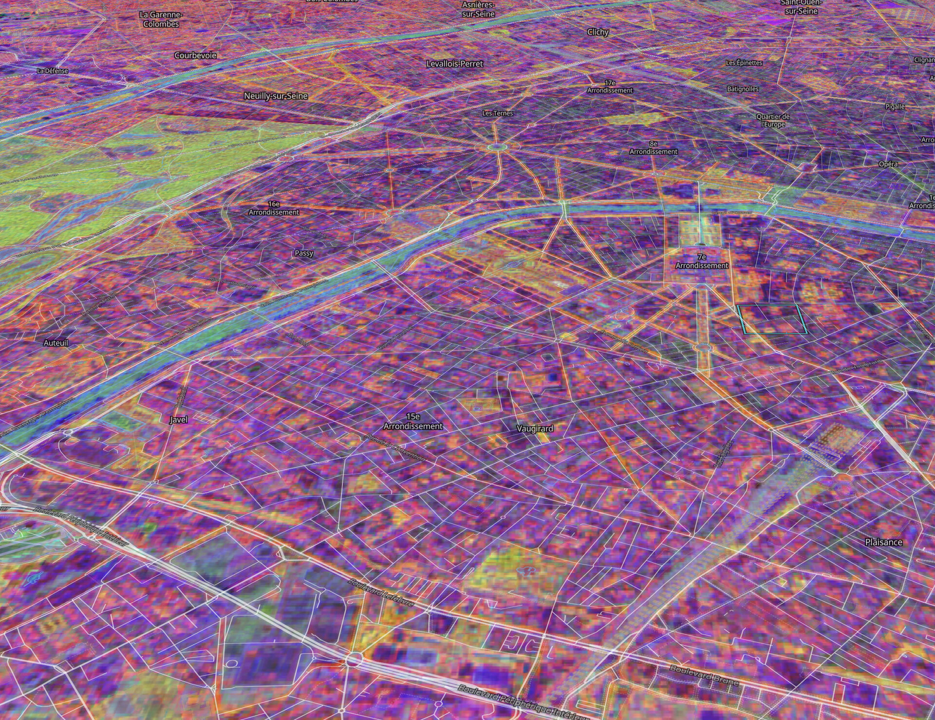
This image shows a satellite photo of Paris, France compared to one of Tessera’s “embeddings”.
Tessera promotes transparency and reproducibility. It is open source and adheres to the FAIR principles (Searchable, Accessible, Interoperable, Reusable), a set of widely adopted guidelines developed by the international research community regarding the reusability of digital assets.
It provides an open and transparent alternative to systems such as AlphaEarth Foundations, an AI model by Google DeepMind. It also compresses complex satellite data from multiple sources to create embeddings using a closed model.
Additionally, Tessera facilitates access to Copernicus data and provides an efficient way to explore Earth observation data.
“The adoption of embedding represents a paradigm shift. Instead of distributing heavy images, models like Tessera can now provide downstream users with a compressed semantic representation of Earth’s surface information embedded in the original data,” said Srinivasan Keshav of the University of Cambridge.
ESA partners on Earth observation models
Several teams are working on basic models for Earth observation, and Europe is at the forefront of this field. ESA has also pioneered the development of foundational models trained on Earth observation data through its open innovation lab, Φ-lab, a hub and catalyst for Earth observation innovation. Two recently announced foundational models from Φ-lab are Thor, developed by the Norwegian Computing Center, and TerraMind, developed with IBM Research Europe. Importantly, unlike models such as Tessera and AlphaEarth that aggregate information into long-term or annual embeddings, both Thor and TerraMind focus on learning from individual observations and preserving rich spatial context information within a single image snapshot, rather than encapsulating everything into one compressed representation.
Thor (Transformer-based Foundation Model for Heterogeneous Observation and Resolution) is a versatile multimodal foundation model that combines different types of data and is designed to overcome the challenges of both diverse inputs and strict deployment constraints. While most current underlying models are structurally rigid, Thor allows users to adjust internal resolution and optimize computational performance. This model is trained on data from Sentinels 1, 2, and 3. This model was funded and supported through ESA’s Foundation Model for Climate and Society (FM4CS) project.
Landscape above Boston generated by TerraMind
TerraMind, the foundational model released in April 2025, is also multimodal and can answer questions about climate and nature. Rather than focusing solely on downstream tasks, its core innovation lies in learning a unified representation space that coordinates multiple sources of geospatial data such as satellite imagery, topography, land use/land cover, elevation, and geolocation. This enables cross-modal inference and query-based interaction with Earth system data. By collaboratively embedding these diverse sources, TerraMind moves beyond traditional task-specific models to a more general-purpose geospatial intelligence framework. It was trained on a dataset of more than 9 million globally distributed samples across eight complementary data types, including radar from Copernicus Sentinel 1 and Optical Sentinel 2 imagery.