A new review has been published in the magazine Pesticides We found that the combination of AI and remote sensing has reached a level of maturity that allows farmers to move beyond uniform field-wide pesticide use to data-driven, site-specific management that reduces waste, improves yields, and reduces environmental damage.
This research AI – Remote Sensing for Soil Change Mapping and Precision Pesticide Management: A Comprehensive Review of Methods, Limitations, and Climate-Sensitive Applicationsreveals how machine learning and remote sensing are reshaping soil monitoring and pesticide decision-making at scale.
Mapping soil variation beyond traditional sampling
For decades, soil management has relied on sparse field sampling and average recommendations. Although this approach is effective in relatively homogeneous landscapes, it does not work in real-world fields where soil properties can change dramatically over short distances. This review shows that such fluctuations are not the exception but the norm, especially in irrigation systems, areas with high salinity, and climate-stressed environments.
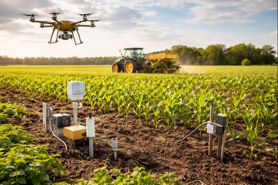
Remote sensing provides a way to observe this variation continuously and non-invasively. Satellite platforms such as Landsat and Sentinel repeatedly cover entire agricultural areas, and drones provide ultra-high resolution data at the field level. These data sources collect information across visible, infrared, tropical, and radar bands and reveal patterns related to soil moisture, salinity, organic matter, and nutrient status.
The main advancement identified in the review is the use of AI to convert these raw signals into actionable soil information. Machine learning models such as random forests, support vector machines, and deep learning architectures are increasingly capable of predicting soil properties with accuracy levels that match or exceed traditional laboratory analysis when validated against ground truth data.
Across the reviewed studies, prediction accuracies for important soil properties such as salinity, moisture, and nutrient content often range between 80 and 97 percent, depending on sensor resolution, model selection, and calibration quality. These results are most powerful when multiple data sources are fused, combining satellite imagery, drone surveys, and in-situ sensor measurements.
The transition from point-based sampling to continuous soil mapping represents a tectonic change in the way soil information is produced. Farmers and agronomists gain dynamic soil intelligence that can be updated throughout the season and growing cycle, rather than relying on occasional inspections that can miss critical fluctuations. This review highlights that this capability is particularly valuable in environments where soil conditions change rapidly due to irrigation, salinization, or extreme weather events.
Reduce pesticide use while maintaining productivity
Studies have shown that using AI-powered soil maps to guide variable fertilizer application reduces fertilizer use by 15-30% without impacting yield. In some cases, yields may increase, especially in heterogeneous fields where the use of uniform inputs previously resulted in over-application in some zones and under-application in others. Yield increases of 8 to 15 percent have been reported in highly variable or degraded soils when inputs are matched to local conditions.
Pesticide use shows a similar pattern. AI systems enable more targeted interventions by identifying zones of stress, salinity, and nutrient imbalance that make crops susceptible to disease and pest pressure. The review found that systems that move from surface spraying to site-based treatment based on AI remote sensing models can reduce pesticide use by 20 to 40 percent.
Water management also has benefits. Soil moisture predictions from remote sensing and AI models can improve irrigation schedules, reducing water use by 25-40% in some irrigation systems. These benefits are particularly evident in arid and semi-arid regions where water scarcity is a limiting factor for agricultural expansion.
The environmental impact is significant. Reducing fertilizer use reduces nitrate leaching and phosphorus runoff, two major causes of water pollution and eutrophication. Reducing pesticide inputs reduces ecological toxicity and occupational exposure. Improving irrigation efficiency reduces energy demand and slows groundwater depletion.
This review highlights that these benefits are most pronounced when AI models are integrated into decision support workflows, rather than treated as standalone analytics. Successful implementation will link soil forecasts directly to variable rate devices, management zones, or advisory systems, allowing farmers to act without extensive technical intervention.
Scaling challenges and the future of digital soil systems
Despite strong technical performance, the review reveals that widespread adoption remains uneven. One of the most persistent barriers is data fragmentation. Remote sensing datasets, soil samples, weather records, and farm management data are often collected using different standards, resolutions, and preprocessing methods. This lack of interoperability makes it difficult to transfer models across regions and aggregate insights at national and global scales.
Model generalization is also a challenge. AI systems trained in one environment can be less accurate when applied to different soil types, climates, and cropping systems. This review highlights that soil processes are highly context-dependent and models need to be readjusted or adapted to local conditions to remain reliable. This requirement increases costs and slows adoption, especially in areas where data is scarce.
Economic feasibility also drives adoption. Satellite data is increasingly accessible, but high-resolution drone surveys, sensor networks, and AI expertise still require investment. While large commercial farms and research-intensive regions are well-positioned to absorb these costs, small-scale farmers may struggle without public support and cooperative models.
This study identifies several new directions that may address these limitations. Physics-based neural networks are one promising way to embed known soil, water, and salt dynamics directly into AI models, improving stability and reducing data requirements. By constraining their predictions to within the laws of physics, these models perform better in data-poor environments and changing climate conditions.
Digital soil twinning is another important concept highlighted in the review. These systems create a continuously updated virtual representation of soil conditions that integrates remote sensing, sensor data, and management history. Digital soil twins enable scenario testing, early warning of salinity and nutrient stress, and long-term planning under different climate and management assumptions.
Federated learning is presented as a potential solution to data governance problems. Instead of centralizing your farm's sensitive data, you can train models across distributed datasets while keeping your data local. This approach improves model robustness, protects farmer privacy, and resolves one of the societal barriers to AI adoption in agriculture.
Policy and institutional support emerge as decisive factors. This review argues that investments in open data standards, digital infrastructure, and enhanced services are essential to move AI remote sensing systems from pilot projects to everyday agricultural practice. Training programs that help farmers interpret AI output and manage uncertainty are equally important to build trust and avoid abuse.