
Delivering food through conflict zones, minefields and floods can put humanitarian workers at risk of death.
Now, technology developed to control probes on distant planets is being applied to remove aid workers from some of the world’s most dangerous aid missions.
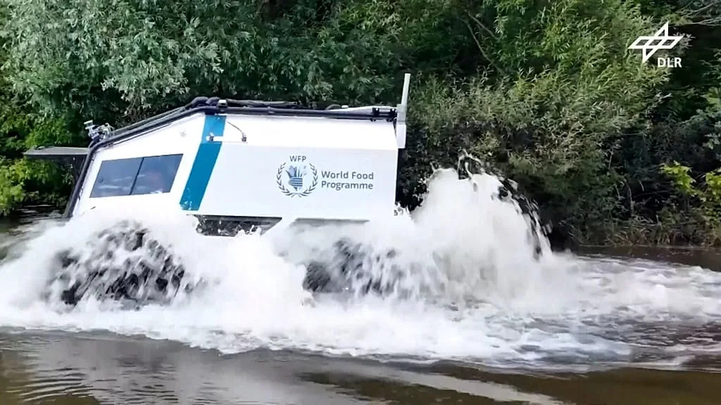
Project AHEAD, a collaboration between the World Food Program, the German aerospace research center DLR, the Red Cross, and technology partners, is developing remotely operated vehicles that can transport supplies through areas considered too dangerous or difficult for traditional delivery trucks.
Footage from Germany’s DLR proving ground shows the SHERP all-terrain vehicle entering open water and climbing over rough terrain.
Sensors scan the terrain ahead and an operator remotely controls the vehicle, allowing it to travel without anyone at the wheel.
The system leverages DLR’s experience in developing remotely operated and autonomous planetary rovers, including the MMX rover, which was built to explore Phobos, one of Mars’ moons.
Similar efforts to leverage emerging technologies in humanitarian work extend beyond physical deliveries.
HungerMap Live is a publicly available platform developed by the World Food Program that uses machine learning and near real-time data to track food insecurity in more than 95 countries.
The organization says it combines information on factors such as conflict, weather, climate disasters and economic conditions to help identify emerging hunger crises.
“Everyone can check the Hunger Map live on the internet. We have real-time data available, and we are currently looking at food security forecasts 90 days ahead,” said Bernhard Kowach, Director of Global Accelerator Ventures at WFP.
related
Map disasters using AI
Reliable maps are also important for humanitarian response. Without information about roads, buildings, and populated areas, aid workers may struggle to decide where to evacuate people, set up shelters, and deliver supplies.
After two powerful earthquakes struck northern Venezuela in June, limited geographic data made it difficult to assess damage and prioritize assistance.
The humanitarian organization OpenStreetMap team says it used machine learning to extract information about buildings from satellite images. Volunteers then reviewed the images through the MapSwipe app and marked areas where they thought structures were damaged.
“Within four days after the earthquake, we were able to mobilize over 600 volunteers, who basically swiped left or right on a mobile app and said, “Yes, this building area is damaged, and no, this building area is not damaged,” said Leanne Dhondt, director of technology and data for the Humanitarian OpenStreetMap team.
“And that allowed first responders to get to the right areas to get food deliveries and all the other necessities that might be needed in the immediate aftermath of an earthquake,” Dhondt added.
No matter how much speed AI can add, Dhondt said the technology still can’t match the accuracy of the detailed work performed by human mappers.
“Manual mapping still provides the best quality, but sometimes speed is more important,” she said.
“In some cases, it’s more important to know more or less where a building is. Even though the building is not completely mapped, we know how many people live in that area. That’s where AI and machine learning models come in now.”
Despite rapid progress, insiders say such systems are still far from being routinely incorporated into emergency responses around the world.
“Currently, there is no system that is really integrated into these emergency protocols in most countries,” said Monique Kuglitsch, innovation manager at the Fraunhofer Heinrich Hertz Institute.
“There are exceptions. In India, we have an AI-based early warning system in operation. In Europe, we also have an AI forecasting system from the European Center for Medium-Range Weather Forecasts, which is in operation. However, in many countries it is still in the experimental stage.”


